
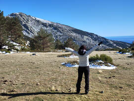
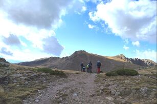
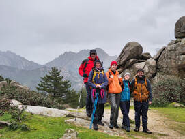
¡Weekend or weekday, no matter when, we can plan a hike for you.
You will practice sport, know new people, learn about nature and have a great time!
You will practice sport, know new people, learn about nature and have a great time!
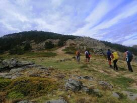
There are different types of hikes depending on the difficulty level but we have for everyone so don´t worry.
From an easy hike to a demanding route with long distance trails, high altitude and technical climbing with ropes, crampons, etc...
From an easy hike to a demanding route with long distance trails, high altitude and technical climbing with ropes, crampons, etc...
easy hikes
For people starting in the sport of mountaineering or coming back from an injury or just a long period without practicing it. Well marked tracks and easy to walk.
0km < LENGTH < 10km
ACCUMULATED POSITIVE HEIGHT <500m/600m
ACCUMULATED POSITIVE HEIGHT <500m/600m
INTERMEDIATE
People with previous experience doing easy hikes or having a good shape, even if they had not made mountaineering before. The main difference with easy hikes level is the accumulated positive height. Distance is going to be similar as in easy hikes, but there couldn be some sections walking out of trails. In any case, no specific technical climbing is needed.
0km < LENGTH < 10-12km
500m/600m < ACCUMULATED POSITIVE HEIGHT < 800m
500m/600m < ACCUMULATED POSITIVE HEIGHT < 800m
DEMANDING
It is mandatory to have previous and long term experience in mountaneering as well as practice it regularly. Great shape is needed. These kind of hikes demand a lot of time in the mountains, and accumulated positive height. Also technical climbing can be involved. You have to be self-sufficient in terms of hydration, eating, equipment and progression techniques thorough any kind of terrain. You could face adverse weather conditions.
LENGTH > 10-12km
800m < ACCUMULATED POSITIVIE HEIGHT < 1200m
800m < ACCUMULATED POSITIVIE HEIGHT < 1200m
VERY DEMANDING
A next step of demanding hikes. More length, more accumulated positive height, isolated places, sections with mantained technical requirements. These are hard routes, mainly focused in Mountaineering as a Sport, trying to reach a big summit, or completing a difficult route, The pace will be high and usually you will have to carry a more heavy backpack.
10-12km < LENGTH > 20km
ACCUMULATED POSITIVE HEIGHT > 1200m
ACCUMULATED POSITIVE HEIGHT > 1200m
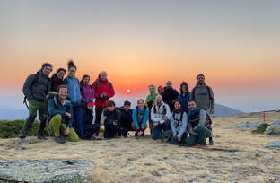
Take a look to some of our hikes, but there are many, many more.
Just tell us what your expectations are, and we will design a route for you.
Just tell us what your expectations are, and we will design a route for you.
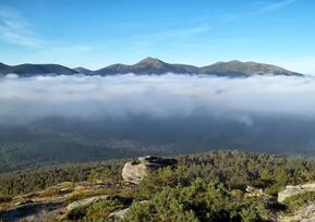
San Blas Valley/ Hoya de San Blas
This hike will take us through the fantastic landscape of the Hoya de San Blas, a wide valley between La Pedriza to the west and Najarra to the east. A dense pine forest covers its slopes, and the zig-zag narrow path climbs up to the beautiful and charming Hoyo Cerrado (1776m), a small meadow that opens at the edge of the forest, crossed by the waters of a singing stream. - LEVEL: INTERMEDIATE. - TOTAL LENGTH: 12,30 km . - ACCUMULATED HEIGHT +: 679 m. |
The Long Sierra/ Cuerda Larga
From Puerto de Navacerrada to Puerto de la Morcuera, the entire Sierra de la Cuerda Larga. This is a classic trail almost so called mountaineer have done. Do you want a tough challenge?. Well, take this one! 21km and about 1,200m H+ at elevations almost always above two thousand meters. This activity can be done throughout the year, although in winter is the hardest season. High winds, below zero temperatures and snow slopes. More pleasant it is to do it on a summer night, with full moon, and watching sunrise from the top of a two thounsand peak. - LEVEL: DEMANDING - TOTAL LENGTH: 21,00 km . - ACCUMULATED HEIGHT +: 1200 m. |
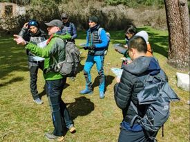
Mapa y Brújula/Using Map and Compass
GPS technology is great, and over the past years even almost every smartphone includes dedicated GPS. Also a lot of hiking apps have been released, but... What happens if there is not phone coverage?, or you run out of battery? The only way to finish the hike and return safe and sound is knowing how to use your map and compass. We will teach you the skills so you can do it. You will practice the operations involved in compass navigation so you get a proper mastering of them - LEVEL: EASY - TOTAL LENGTH: - . - ACCUMULATED HEIGHT +: -. |
7 Picos loop trail /Cirucular de 7 Picos
This is one of the most historic trails you can hike in the Sierra de Guadarrama. The hiking paths are living history of Madrid and Spanish Mountaineering. Navacerrada Pass, Schmidt trail, Telégrafo peak, Valsaín,.. all names we have grown up with in Madrid. So, this route will allows to remember the stories of these first mountaineers, while following the same paths they traced a long time ago. - LEVEL: INTERMEDIATE. - TOTAL LENGTH: 10,60 km . - ACCUMULATED HEIGHT +: 450 m. |
Wolf´s Peak/ Pico del Lobo (2274m)
El Pico del Lobo es una de esas montañas que los montañeros queremos ascender nada más verla. Su silueta, su nombre, su altura y los contrafuertes rocosos de su cara Norte, le dan un atractivo al que es difícil resistirse. Esta montaña es la más elevada de la Sierra de Ayllón, continuación de la Sierra de Guadarrama hacia el Este. Situada entre los puertos de Somosierra y de la Quesera alcanza una altura de 2274m. El itinerario elegido y nuestro favorito, asciende por un trazado mucho menos transitado, que muy pocos conocen, de gran valor natural y que permitirá apreciar la magnitud de la montaña. - LEVEL: DEMANDING - TOTAL LENGTH: 16,50 km . - ACCUMULATED HEIGHT +: 975 m. |
Cueva Valiente (1903m)
Esta montaña de 1.903m se desgaja hacia el Norte de los Montes Escurialenses. Partiremos de la población de El Espinar, nada más pasar los túneles de Guadarrama, e iremos ganando altura por los pinares que tapizan las laderas de Cueva Valiente. Tras remontar el espolón noreste alcanzaremos la pradera de cumbre, donde se encuentra su característico refugio. Merecido almuerzo y disfrute de las vistas, para a continuación descender hacia el Norte y visitar la cueva que da nombre a esta montaña. - NIVEL: FÁCIL - LONGITUD TOTAL: 12,00km. - DESNIVEL POSITIVO ACUMULADO: 600m. |
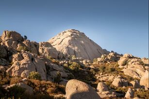
El Yelmo (1718m)
El Yelmo es quizá la cumbre más famosa del gran batolito granítico de La Pedriza. Coronando en altura la denominada Pedriza anterior, con sus 1.718m de altura se yergue imponente el Yelmo, que hace gala a su nombre y bien pudiera ser la coraza o escudo de un caballero gigante petrificado. En su cara Noreste, se abre una fisura, que deja una angosta chimenea, por la que se puede subir. Ello exige una escalada fácil o trepada hasta salir de ella prácticamente en su cumbre. - NIVEL: INTERMEDIO. - LONGITUD TOTAL: 10,00 km . - DESNIVEL POSITIVO ACUMULADO: 843 m. |
La Maliciosa (2274m)
La Maliciosa es uno de los dosmiles más conocidos de la montaña madrileña. Su silueta escarpada e imponente es de las primeras que se ven al acercarse a la zona de Navacerrada y Cercedilla. Sus vías de ascenso son numerosas, desde todas su caras. En esta ocasión, ascenderemos por su vertiente Este, desde el fondo del valle del río Manzanares, en La Pedriza. Es esta, una de sus ascensiones más duras (10,5km y 1150m de desnivel positivo hasta su cima). - NIVEL: EXIGENTE - LONGITUD TOTAL: 10,50 km . - DESNIVEL POSITIVO ACUMULADO: 1150 m. |
Peña Cítores (2181m)
A hombros de la cumbre más alta de Madrid hay una cima que pasa desapercibida para la mayoría. La sombra de Peñalara es muy alargada. Se trata de Peña Cítores, de 2.181m de altitud y que ofrece amplias vistas de Cuerda Larga, de Peñalara, de Segovia, historia de trincheras, pinos de valsaín, … El descenso visita antiguas trincheras de la guerra civil y conectaremos con el PR-M/SG-3 hasta llegar al Puerto de Cotos (1.830m), para descender hacia el punto de inicio por el Camino viejo del Paular (GR10.4 y GR10.1). - NIVEL: FÁCIL - LONGITUD TOTAL: 13,30km. - DESNIVEL POSITIVO ACUMULADO: 850m. |
